I spent a couple of days in Thredbo. On Sunday there was a mountain bike (MTB) event ‘The Thredbo Enduro’. The event used the ‘gravity tracks’ that run through the ski slopes. Some of the riders can only be described as being crazy. Even before the competition started there were two broken collar bones.
The running of the Enduro thwarted my plan to do some runs on the mountain. On Monday after the event, the MTB operator “had too much on” to rent me a heavy bike. They must have made a lot of money on the event.
To Khancoban
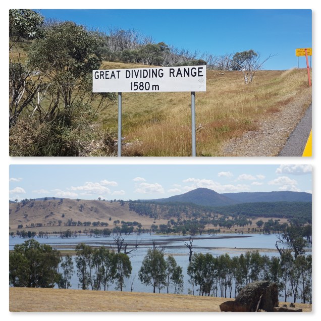
My next stop was Khancoban. The route took me over Dead Horse Gap on the Alpine Way. I have been on this road lots of times – travelling to Melbourne with my parents in the 1960’s and 70’s, on my motorbike, when I worked on the Snowy Mountains Authority audit with the Australian National Audit Office, and on my bicycle.
Remembering not getting the Headwaters of the Murray
The last time the I was on the road was back in March 2013 when I went on ride with one of my Canberra hosts towards the headwaters of the Murray. We were retracing the route we took on our trail bikes back in 1976. My post on this ride on the blog. As you will read, we didn’t make it to the headwaters of the Murray.
Remembering my Biggest Climbing Day Ever
The other time that I rode my bicycle on the Alpine Way was back in October 2012. This was on a ride from Wangaratta to Canberra via Corryong. I recall leaving Corryong quite early in the knowledge that I had a big day ahead of me.
I stopped briefly in Khancoban where I dropped into the NSW Parks and Wildlife Service to get some advice of possibility riding on the Geehi Fire Trail rather than the Alpine Way. I recall that the woman giving the advice was strikingly attractive. She told me that ford crossing on the trail was too high to pass.
As I headed out of Khancoban I came across lots of motorcycles heading the other way. They were travelling to Phillip Island for the Australian Moto Grand Prix.
At one point I was passed by an Ambulance followed by the about ten bikes. A little further on I came across the scene of the accident. There was a Triumph Speed Triple lying on the road. I chatted briefly to the policeman at the scene. He told that “this happens every year. We expect more as they ride back home after the races”.
It was long slog up the Scrammells Spur. From the spur there is a great view towards the ‘Main Range’. This is followed by a really steep descent to the Geehi River valley. There is then I bit of up and down before you get to Tom Groggin. There has been a cattle station there since the mid 1800’s.
From Tom Groggin there is some more up and down and then follows an 8 klms ascent to Dead Horse Cap.
I can recall that on my 2012 ride, it seemed to take forever to get to Dead Horse Gap. The trees just didn’t seemed to be getting in smaller and it was ages before I came upon some snow poles. It was dark when I finally I cruised down the hill into Thedbo village.
I have looked back on the statistics for that day. The moving time was 8 hours and 17 minutes and climb was 3,057 metres and I consumed 5,445 calories. A big day
Still Tough Going the Other Way
Of course this time was going in the other direction. This involved a steady climb to Death Horse and then the 8 klms descent towards Tom Groggin. I wasn’t stupid with the descent, but it was still a bit of a thrill. Check out the GoPro video on Flickr.
It is a fairly easy ride to the Geehi River. At one point, I came across a cyclist coming the other way. We chatted for a bit. He was bloke in 30’s and he had ridden from Khancoban. His plan was to stay at Tom Groggin overnight before making the climb up to Thredbo. I told him about my 2012 ride and he seem to be a little impressed.
I stopped at the Geehi River for a rest. I chatted to two blokes on Moto Guzzi motorbikes. They wished me luck on the climb that was ahead.
The really steep part of the climb started in about 4 klms and went for about 10 klms.
I have explained to people who care to listen that the roads in the Australian Alps and in the Tasmania are steep because they were constructed in the 1960’s and the 1970’s after the advent of powerful internal combustion engines. Many of the roads in the European Alps like the Furka and Simplon Passes, both of which I have climbed, were constructed in the days of the steam engine. While the passes are high, the roads are not that steep, rarely great then 5% gradient.
Most of this part of the Alpine Way has a gradient of around 10%. It is a seriously hard climb.
It was a relief to get the Scammell’s Spur. From there it was almost all downhill to the Murray Two Power Station and onto Khancoban.
I stayed in the Khancoban Hotel.
Walwa
From Khancoban, I headed towards Corryong before turning off towards Tintaldra where I cross the Murray River for the first time.
It was quite tough riding over undulating countryside. While of course – if you go up, you must come down – you never up for the effort on the up.
It was late when I arrived in Walwa. I checked into the Hotel. It is another classic country pub. The publican, is however, a bit of a Basil Faulty. He thought I was very odd when I used my phone to pay my tab bill.
In the morning, I had breakfast at the one and only café in town. I was good. I had a chat with some ‘grey nomads’ who expressed great interest in my travels.
Granya
The road west from Mulwa took me close to the Murray River. It is a very nice part of the world.
It is not long, however, before you come across the upper reaches of Lake Hume, which is formed by the damming of the Murray near Albury. This is a very big lake.
I had booked in the Granya Pub.
It was late in the afternoon when I came to an intersection with signs to Granya and Albury and the Hume Dam. I took the turn off to Granya. After about 3 klms, I came across a few houses. This was Granya. There was no Pub to the seen. I saw woman in the garden of one the houses and asked, “can you give me directions to the Granya Pub”. She replied that the “Pub isn’t in Granya”. I ‘thought here we go. WTF is it?’.
She told me to “head back to the intersection and take the road towards Albury, the pub is 300 metres on the left”.
I found the pub and checked in. I was one of three quests. Th publican told me that the place was built in 1908. In the 1960’s it was turned into a “drug and alcohol rehabilitation centre” (somewhat ironic). The centre ceased operation about ten years ago and the place had fallen into disrepair. He had taken it over and was trying to get it back to being a successful Pub. This is a big ask.
Albury
The next day I rode along the lake’s edge and into Albury.
Flickr Links
Over the Mountains October 2012
https://www.flickr.com/gp/twwilko_photos/xi21kp
To Cascade Hut in 2013
https://www.flickr.com/gp/twwilko_photos/e34xb2
To Albury
Garmin Links
Khancoban
https://connect.garmin.com/modern/activity/1596768128
Walwa
https://connect.garmin.com/modern/activity/1597366053
Granya
https://connect.garmin.com/modern/activity/1600564657
Albury
https://connect.garmin.com/modern/activity/1600564709
Back in October 2012
https://connect.garmin.com/modern/activity/236886746
To Cascade Hut March 2013
https://connect.garmin.com/modern/activity/283117670
